Thanks for subscribing.
Your gift is on the way.



DevsData LLC partnered with a Norway-based startup to build a mobile navigation app tailored for hikers, cyclists, and outdoor enthusiasts exploring the country’s landscapes. Over a five-month collaboration, we developed the MVP and first production version entirely from scratch using a modern cross-platform mobile tech stack. The result was a highly rated community-driven platform downloaded by more than 13000 users within the first six months after launch.
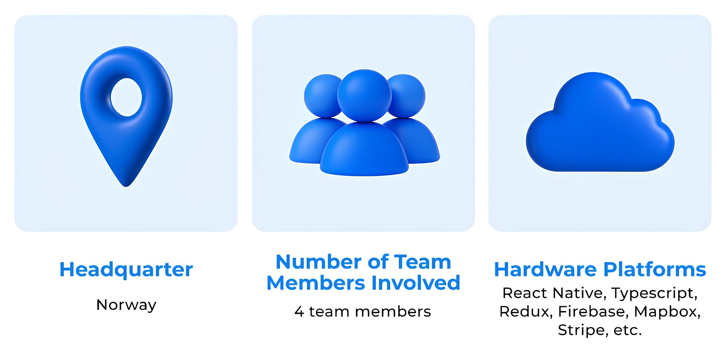
The client was a Norway-based outdoor-technology startup established in 2021, founded by a small team of engineers and entrepreneurs with backgrounds in geospatial data, mobile product design, and tourism services. The company set out to modernize how outdoor information is accessed and shared across Scandinavia, aiming to bring more structure, accuracy, and accessibility to a fragmented ecosystem of trail datasets, local guides, and regional tourism resources. Typical use cases included identifying safe routes during changing weather, discovering lesser-known trails, or coordinating equipment rentals and guided tours in one place.
Operating with a lean team and a product-first mindset, the startup built early momentum by partnering with local outdoor associations, regional tourism boards, and equipment rental providers. This gave the company access to valuable datasets and helped validate the demand for digital tools that could support Norway’s highly active hiking and adventure-travel community. The founders positioned the company as a technological bridge between outdoor service providers, local businesses, and a growing community of nature enthusiasts.
After securing initial traction and investor interest, the company was later acquired and merged into a larger Scandinavian outdoor-services group, with the transaction details covered under an NDA. The application stack centered on a React Native client speaking to Firestore for live data, Stripe for payment flows, and weather feeds sourced from MET Norway. Through the acquisition, that infrastructure and the know-how behind it have been folded into a larger digital push around regional tourism and outdoor safety.
Building a mobile product for hikers in Norway presented a unique mix of technical, geographical, and operational complexities, with data sitting at the heart of the difficulty. The founders wanted to create a reliable tool for outdoor navigation in a country where terrain varies dramatically. Coastal trails, dense forests, and high-altitude mountain routes each demand different mapping data, elevation models, and routing logic to ensure accuracy and safety. Compounding this, connectivity fluctuates or disappears entirely across remote regions, which meant the platform had to combine accurate live map data with reliable offline availability and a fluid experience under inconsistent network coverage.
The community-driven model layered a second set of data challenges onto the build. The startup envisioned a platform where users could add new trails, review locations, form groups, and exchange messages. Those features depend on a robust backend, scalable infrastructure, and secure data synchronization across thousands of devices. Maintaining map accuracy while ingesting user contributions raised harder questions still: how to validate incoming geometry against existing datasets, how to deduplicate points of interest at scale, how to moderate condition reports without slowing the contribution loop, and how to render dynamic data on the map without degrading performance.
Commercial readiness completed the picture. The client needed a solution that would operate as a paying product from day one, which meant integrating geolocation-aware ads, enabling in-app purchases, supporting real-time chat, and preparing for rapid growth despite the early-stage nature of the company. With a limited internal engineering team and an aggressive timeline for releasing the MVP, the startup required an external partner capable of owning full-cycle development, handling both technical and product-level decisions, and delivering a market-ready app that could scale to thousands of users.
The client needed a navigation platform that worked reliably in remote Norwegian terrain while supporting real-time community input and commercial scalability.
To bring the client’s vision to life, we adopted a full-cycle, collaborative approach that covered business analysis, technical planning, and rapid iterative development. Since the startup needed a complete MVP built from scratch, we opened the engagement with a structured discovery phase. Stakeholder interviews with the founders captured business requirements ranging from commercial drivers and partnership commitments to acquisition-readiness expectations. Requirement-gathering sessions then translated those inputs into a prioritized scope document, a feature backlog, and a roadmap for the first production release.
Drawing on prior experience building complex mobile ecosystems, including a Silicon Valley marketplace app for ride-share drivers, we understood how to combine geolocation, in-app payments, user authentication, and real-time communication into a cohesive experience. This background helped us design a modular architecture where maps, content, chat, and authentication could evolve independently without compromising performance.
A core part of our approach was structuring the product for long-term stability and flexibility. We focused on:
Finally, we emphasized transparency and alignment with the founders. Each milestone was delivered as an incremental build, enabling real-device testing, early validation of assumptions, and continuous refinement before full-scale implementation.
To execute the project efficiently and meet the client’s ambitious timeline, DevsData LLC assembled a compact, cross-functional team of four specialists. A dedicated project manager oversaw communication, sprint planning, and expectation alignment with the founders. A senior React Native engineer focused on mobile development and performance architecture, while a backend/cloud engineer handled data storage, real-time synchronization, authentication, and infrastructure decisions. A UX/UI designer completed the team, shaping user flows suited for fast decisions outdoors and ensuring a cohesive visual experience across maps, groups, and trip-planning features.
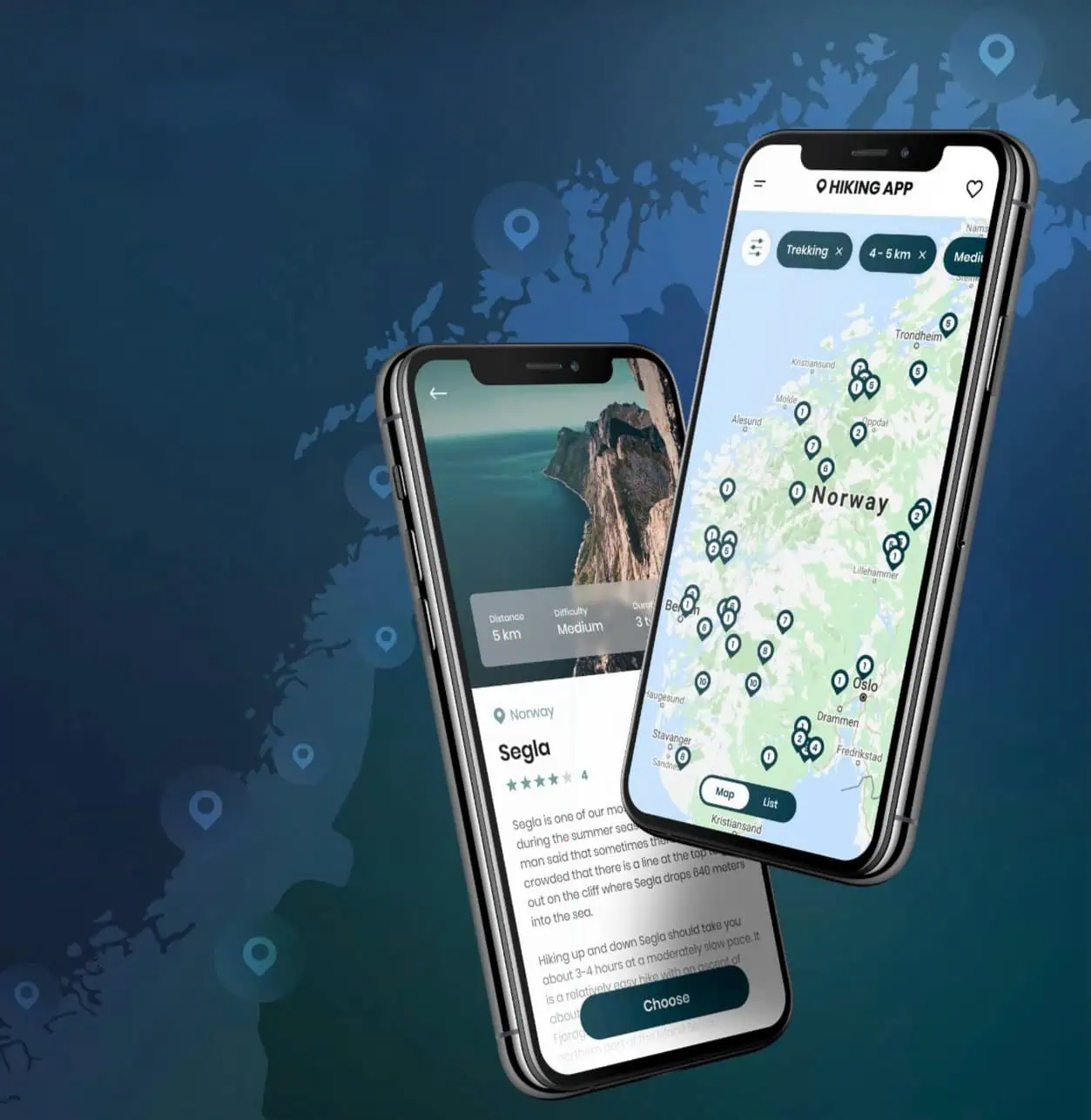
From day one, the collaboration was structured around clear deliverables and continuous feedback loops. Weekly milestone reviews allowed the client to test features directly on their devices, validate UX early, and make product decisions based on real usage rather than assumptions. Because the client needed an MVP that was both technically sound and commercially viable, we prioritized core functionality: navigation, weather data, community contributions, and geolocation-driven recommendations, while designing the codebase to support future growth and investor scrutiny.
We also managed product considerations beyond pure development: preparing the app for app-store submissions, optimizing the onboarding flow against feedback from hikers who tested early builds in real outdoor conditions, and ensuring that integrations such as chat, payments, and weather alerts fit seamlessly into the overall experience. Consistent documentation and transparent planning helped the founders maintain strategic clarity throughout the entire five-month development cycle.
Below is the technology stack that powered the MVP and first production release, structured to support real-time data, outdoor navigation, social interaction, and monetization.
| Area | Technologies used | Purpose |
|---|---|---|
| Mobile Development | React Native, TypeScript | Cross-platform app development with a scalable, maintainable codebase |
| State and Logic Management | Redux, Redux-Saga | Predictable state flow, improved reliability, easier debugging |
| Backend and Infrastructure | Firebase, Firestore, Firebase Auth | Real-time data sync, cloud storage, user authentication |
| Maps and Navigation | Mapbox, OpenStreetMap | High-quality vector maps, customizable navigation layers |
| Communication | SendBird | Real-time chat, group messaging, trip-planning coordination |
| Payments and Monetization | Stripe | In-app purchases, paid listings, and advertising payments |
| Weather and Alerts | MET Norway API | Real-time meteorological warnings and forecasts |
The stack above did not emerge from a checklist. DevsData LLC advised the founders on each major component, presenting trade-off analyses for the mobile framework, the backend platform, and the mapping provider, then guiding the final selection in light of Norwegian terrain rendering, future hiring plans, and commercial timelines. Our advisory remit extended to code-quality standards, CI configuration, and pre-sale technical due diligence, which is how the combination of technologies sustained a high-performance mobile experience while keeping the system flexible enough for the startup’s rapid iteration cycle and future acquisition.
The finished application established itself as a dependable companion for outdoor enthusiasts across Norway. Its smooth performance, clear interface, and dependable map layer made route discovery and trip planning noticeably easier for users exploring both familiar and remote locations. Real-time weather updates and offline functionality contributed to safer and more confident decision-making during outdoor activities.
Community features evolved into a core strength of the platform. User contributions steadily enriched the database with new trails, viewpoints, and local insights, creating a living network of shared knowledge. Within the first year, users added over 4000 trail segments, 1200 points of interest, and tens of thousands of micro-updates such as condition reports and photos, demonstrating both the scalability of the data model and the community’s sustained engagement. Group coordination tools and built-in messaging fostered collaboration among hikers, cyclists, and climbers, helping the app gain a loyal, active user base.
On the business side, the platform demonstrated strong viability early on. Local businesses benefited from geolocation-based exposure, while paid placements introduced a predictable revenue stream. Behind those results stood the full scope of services DevsData LLC delivered: business analysis and stakeholder requirement gathering at the discovery stage, UX research and interface design, mobile development in React Native, backend and cloud engineering on Firebase, third-party integration for chat and payments, app-store release handling, and post-launch advisory through the acquisition process. That breadth of delivery, paired with steady user growth and a well-structured technical foundation, strengthened the company’s strategic position and supported its eventual acquisition by a larger Scandinavian outdoor-services provider.
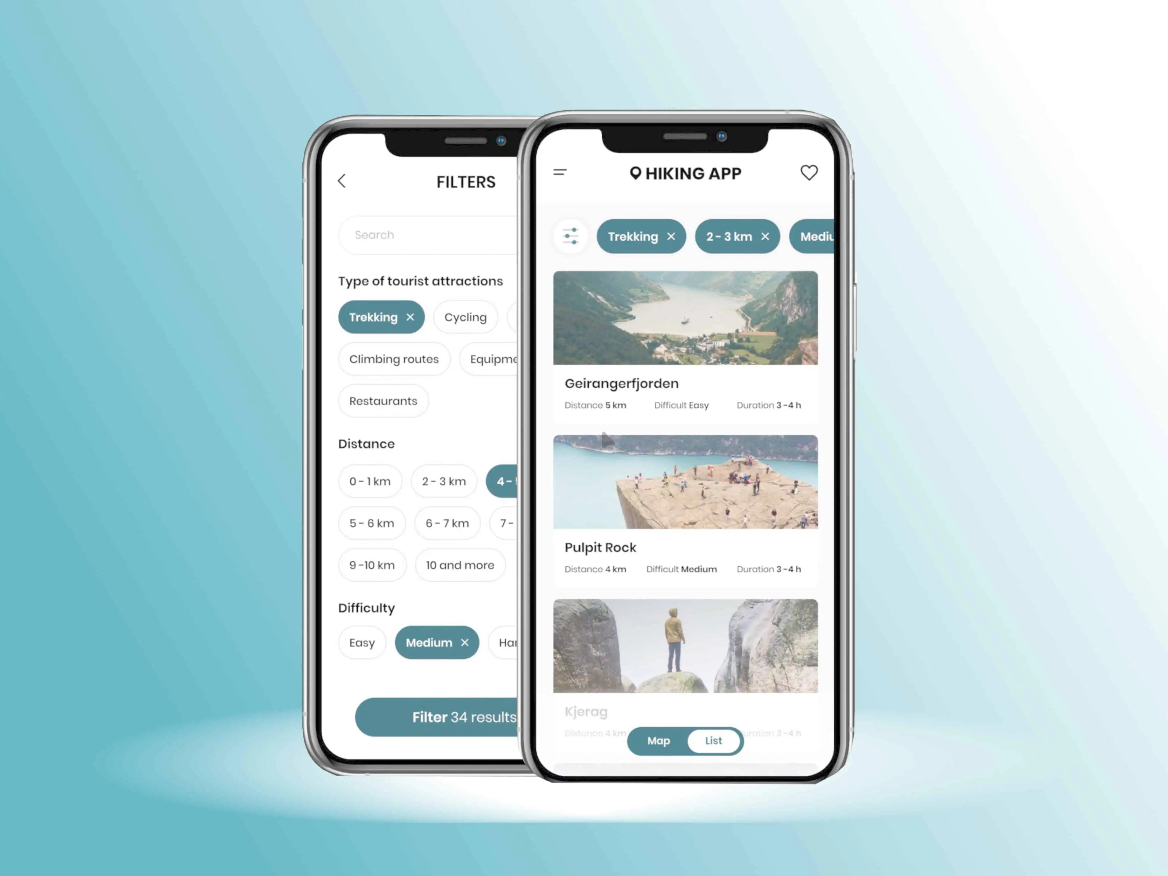
Following the acquisition, the product is being expanded within the parent company’s broader ecosystem of outdoor and travel services. The next development phase focuses on strengthening long-distance route planning, improving offline map capabilities, and refining tools that help users navigate remote terrain more confidently. There are also plans to introduce advanced personalization features, allowing recommendations to adapt to each user’s activity style, skill level, and preferred regions.
From an operational standpoint, the consolidated team is exploring deeper integrations with the buyer’s existing digital products. This includes linking user accounts across platforms, unifying loyalty or membership benefits, and connecting the app to a wider inventory of regional services offered by the parent company. Additional development will continue under NDA, but the roadmap emphasizes expanded coverage, richer environmental data, and new collaboration tools aimed at enhancing group travel and outdoor community building at scale.
As the platform evolves, the technical foundation built during the MVP phase ensures that new modules can be added without disrupting performance, positioning the product for sustainable, long-term growth in the Nordic outdoor-tech landscape.
Ready to build your own location-aware, community-driven mobile product? Leverage our experience in developing high-performance navigation apps, real-time communication features, and scalable cloud architectures.
Contact us at general@devsdata.com or visit www.devsdata.com to discuss how we can help bring your concept to life.
Any questions or comments? Let me know on Twitter/X.
Discover how IT recruitment and staffing can address your talent needs. Explore trending regions like Poland, Portugal, Mexico, Brazil and more.
DevsData – your premium technology partner
DevsData is a boutique tech recruitment and software agency. Develop your software project with veteran engineers or scale up an in-house tech team of developers with relevant industry experience.
Free consultation with a software expert
🎧 Schedule a meeting
FEATURED IN


DevsData LLC is truly exceptional – their backend developers are some of the best I’ve ever worked with.”

Nicholas Johnson
Mentor at YC, serial entrepreneur


 Build your project with our veteran developers.
Explore the benefits of technology recruitment and tailor-made software.
Learn how to source skilled and experienced software developers.
Build your project with our veteran developers.
Explore the benefits of technology recruitment and tailor-made software.
Learn how to source skilled and experienced software developers.

Rebecca Botvin

Commercial Director

Tom Potanski
Manager




Categories: Big data, data analytics | Software and technology | IT recruitment blog | IT in Poland | Content hub (blog)
















careers@devsdata.com









general@devsdata.com

"I interviewed about a dozen different firms. DevsData LLC is truly exceptional – their backend developers are some of the best I've ever worked with. I've worked with a lot of very well-qualified developers, locally in San Francisco, and remotely, so that is not a compliment I offer lightly. I appreciate their depth of knowledge and their ability to get things done quickly."

Nicholas Johnson
CEO of Orange Charger LLC,
Ex-Tesla Engineer,
Mentor at YCombinator
"DevsData reached out to us, as we've been looking to grow our engineering team in Europe and Poland. Communicating efficiently and professionally, DevsData made a strong impression with their understanding of the recruitment challenges we were facing. They designed a tailored recruitment process for our needs. I was impressed with the technical depth of their approach."

Karim Butt
Co-Founder & CTO at GlossGenius, Inc.
"Out of all the vendors we work with, DevsData clearly stands out. The quality of developers they deliver is beyond what we've received from any other vendor, and they've been able to send profile recommendations very quickly. I'm happy to be their reference for other companies from Israel and talk about their recruitment abilities and what they delivered for us."

Ran Eyal
Senior Manager at
ZIM Integrated
Shipping Services Ltd.
"DevsData demonstrated a strong degree of proactivity, taking time to thoroughly understand the problem and business perspective, and continuously suggesting performance and usability enhancements. Their app exceeded my expectations. I've worked with DevsData on numerous projects over the last 3 years and I'm very happy. Being both responsive and honest in communication."

Jonas Lee
Partner & Executive VP of Verus,
Financial LLC, Investor,
& Serial Entrepreneur
Acknowledgments